Hiking the Zêzere Glacial Valley in Manteigas
Trans Serrano walks you through the U-shaped valley carved by ice, starting from Manteigas, from €20. There is an 18 km loop and a shorter 10 km version, and the guide is what turns walking into understanding the landscape.
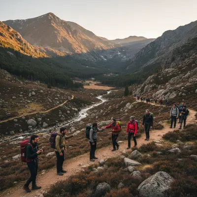
There is a big difference between seeing the Zêzere Glacial Valley from the car, along the road that links Manteigas to Gouveia, and walking it on foot with someone who knows every fold of the terrain. From the road it is a pretty photograph. On foot, with a guide, it is geology you feel in your knees: a U-shaped valley carved by a tongue of ice thousands of years ago, 15 km long, with flocks grazing on the floor and stone shepherd huts pressed against the slope. That is why I chose the guided walk run by Trans Serrano instead of improvising on my own.
Who runs it and what it costs
Trans Serrano (Trans Serrano Aventura, Lazer e Turismo) is an adventure tourism agency based in Góis, in the neighbouring Serra da Lousã, that has worked across central Portugal for years and knows the Serra da Estrela well. The walk is called the Caminhada do Vale Glaciar do Zêzere and starts from €20 per person.
Booking and contacts:
- Website: transserrano.com
- Phone: +351 235 778 938 (Monday to Friday, 9am-6pm)
- Mobile / WhatsApp: +351 961 787 772
- Email: [email protected]
Confirm the date, the minimum number of participants and what is included directly with the provider before paying, because departures usually depend on a group being formed.
The two versions of the route
There are essentially two options, and it is worth understanding the difference before you book.
The full loop (about 18 km)
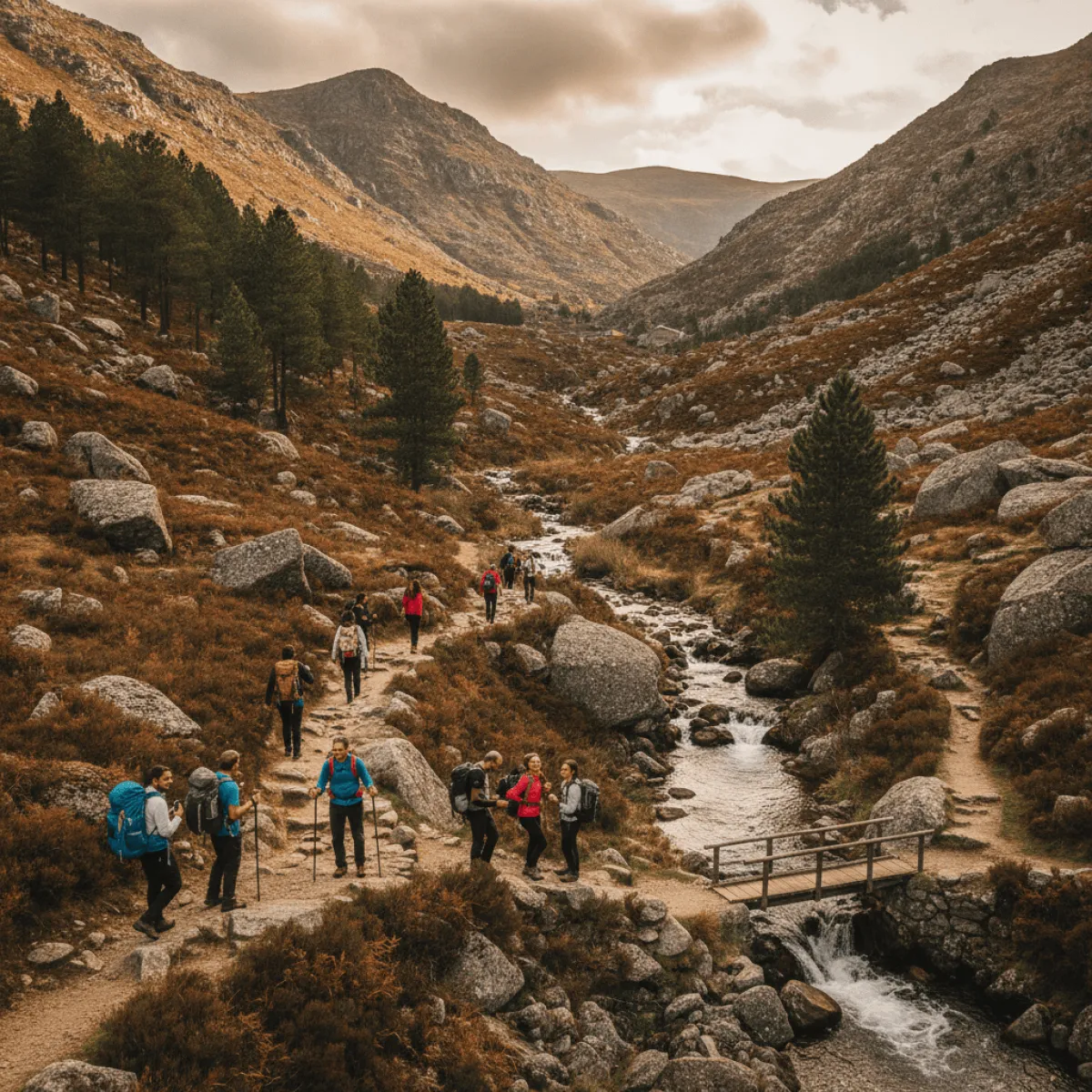
The long version is a circular route of roughly 18 km, 6 to 7 hours on the ground. It is the one I recommend if you have the legs and a whole free day. You climb the slope, cross the plateau and descend along the valley floor, which gives you two completely different perspectives of the same landscape: first from above, with the valley open below you, then down low, with the walls closing in around you.
The short linear (about 10 km)
The shorter version is about 10 km and takes around 3 hours. It is the sensible choice if you are coming with older children, if the weather is unstable, or if you want to save energy for the rest of the weekend. It covers the essence of the valley without the effort of climbing to the plateau.
Difficulty is rated as medium in both cases. This is not mountaineering, but it is not a flat stroll either: there is elevation gain, uneven ground and sections exposed to sun and wind.
What the day looks like, step by step
The meeting point is in Manteigas, on the valley floor. The guide gives an introduction to how the glacier formed before setting off, and this is the detail that changes everything: without that explanation, rocks are just rocks. With it, you start to read the valley, the erratic boulders left by the ice, the striations on the stone, the Covão da Ametade up ahead as the head of the glacier.
The best moment, for me, is mid-morning, when you leave the wooded section and the valley opens up fully in front of you. The morning light hits from the side and draws out every crease of the slope. That is why I always ask for the earlier departure: less heat on the climb and a landscape with shadow and relief, instead of the flattening of midday light.
Along the way you pass pastures, flocks of sheep and the typical stone shepherd houses. Do not rush these sections. This is where you understand that the valley is not just a geological backdrop, it is a working place, alive, with people who still climb up with their animals.
What to bring and what to wear
- Hiking boots with good grip. The terrain is stony and there are descents where your ankle will thank you for the support.
- Layers. Even in summer, the wind on the plateau cools you quickly. Bring a windbreaker.
- Real water: at least 1.5 to 2 litres on the long version. Do not count on guaranteed springs.
- Hat, sunglasses and sunscreen. There are stretches with no shade at all.
- Snacks or a packed lunch for the full loop.
When to go and when to book
The best time is from spring to early autumn. May and June give green meadows and full streams; September and October give golden light and fewer people. In winter the valley is spectacular under snow, but then the walk depends heavily on conditions and may not run, so always confirm. If you come in that season, it is worth reading our guide on where to sleep in Manteigas when snow falls first.
Book ahead, especially on weekends and public holidays, because the departure depends on a group. Ask whether there is a guaranteed departure on the date you want.
How to get there and where to stay
Manteigas is reached by car, usually via the A23 and then the mountain road. There is no practical public transport to the starting point, so plan on having your own vehicle. To turn this into a relaxed weekend, it is worth sleeping in the village: Casa da Vila in Manteigas is a good base in the centre.
After the walk, the right ritual is an unhurried meal. Café Caramelo sorts out the hunger of anyone who has come down off the valley. And if you want to take the mountain home, read our guide on buying Serra da Estrela cheese direct from producers.
Is it worth it?
It is, for one simple reason: the guide makes the difference between walking and understanding. If you already hike well and just want legs on the trail, doing the glacial valley hike on your own also works. But if it is your first time in the Zêzere, or if you want to read the landscape instead of just looking at it, the guided version from Trans Serrano is money well spent. For more context on the mountain and the village, see our guide on the snow wells trail and the serra done properly.