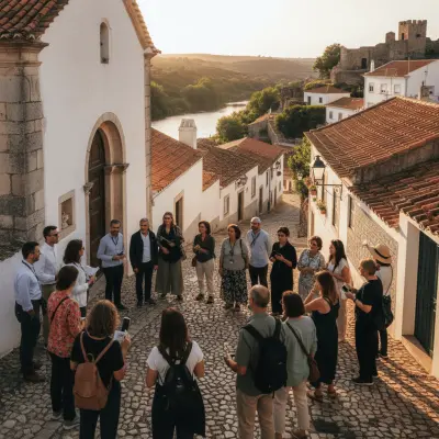
Pulo do Lobo Hike From Mértola: A Local Guide
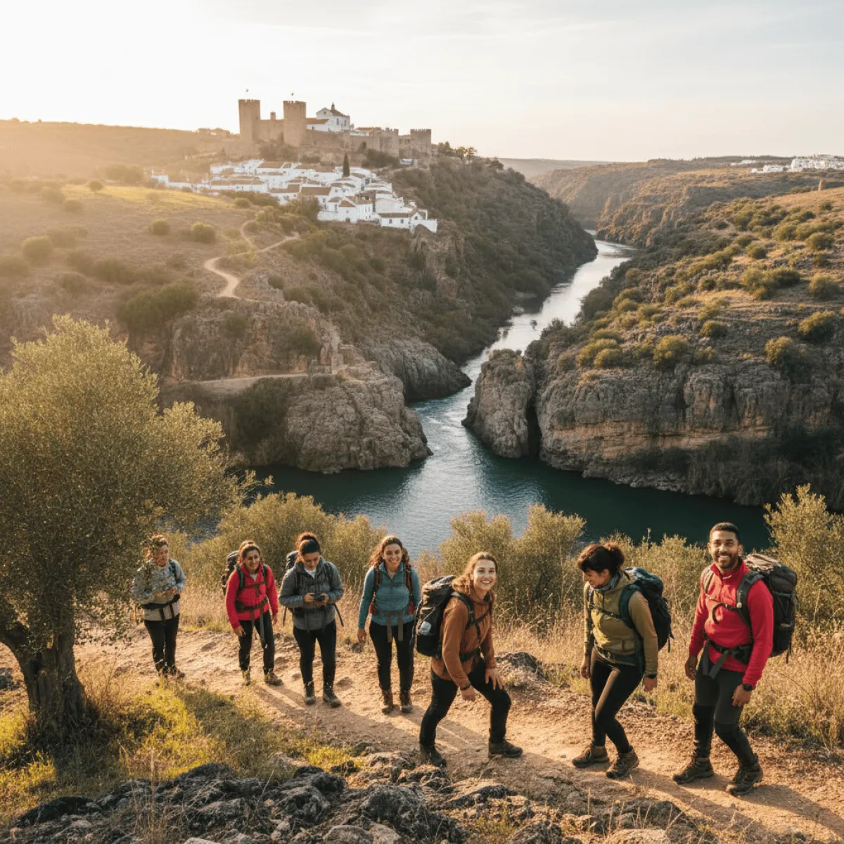
The largest waterfall in southern Portugal drops 16 metres through a slate corridor 25 km from Mértola. GreenTrekker runs this 7 km, four-hour guided hike with insurance and stops at the right places to spot black storks.
Pulo do Lobo isn't a casual stroll. It's the largest waterfall in southern Portugal, tucked inside a slate corridor where the Guadiana squeezes between rock walls and drops about 16 metres as if it had somewhere urgent to be. From Mértola it's roughly 25 kilometres by road, but the last stretch is dirt track and plenty of drivers turn back when they see the potholes. That's the practical reason to go with a guide: GreenTrekker runs this hike a few times a year with insurance, GPS, and someone who knows exactly where to stop to spot the black storks.
Who runs it, what it costs, how to book
GreenTrekker (Caminhar & Explorar, Lda.) is a licensed Portuguese nature tourism operator (RNAAT Nº 1414/2016) operating since 2011. They don't run the Pulo do Lobo hike on a fixed weekly schedule, but they organise it on selected dates and accept group requests. Previous editions ran at 10 euros per person; confirm the current price directly with the provider.
To book, three options:
- Email: [email protected]
- Phone: (+351) 967 357 858 or (+351) 918 738 770
- Website: greentrekker.pt
The price covers the professional guide, personal accident insurance, and civil liability insurance. It doesn't include transport to the meeting point or food.
The route, step by step
The meeting point is the entrance gate of Herdade do Pulo do Lobo. GPS: 37°48'35.3"N, 7°38'40.3"W. From Mértola, follow the road to Corte Gafo de Cima, then to Amendoeira da Serra, then a narrow road to the gate. First-timers should allow 45 minutes to an hour from central Mértola, with at least one moment of the GPS giving up.
The hike usually starts at 10am. About 7 kilometres in a loop, 320 metres of cumulative elevation, four hours total including stops. The first stop is the Anta das Pias, a megalithic site that very few visitors to the region even know exists. From there the trail drops onto dry slate paths down to the ruins of an old mill, where the millstone is still visible. The guide pauses here to explain how millers harnessed the current, and the group moves on to the main viewpoint.
The first sight of the falls is strange. You hear them before you see them. The Guadiana, which had been running wide and calm, suddenly narrows to a few metres and the water starts to roar. On high-flow days, mist rises to the top of the cliffs. In August the drop is thinner, but the pools below take on a marbled green only possible when the river has stopped pushing sediment.
The return follows a different track, through a valley shaded by ash trees. It's the only stretch of the day where the pace slows naturally.
Real difficulty, not the brochure version
GreenTrekker rates this hike as level 3 of 5, "demanding". They're not exaggerating. The 320 metres of elevation come in short descents and climbs on loose stone. Some sections run close to unprotected cliff edges. It isn't climbing, but if you have vertigo or haven't tackled a real incline in a while, you will feel it.
Children under 10 should skip this one. Above that age, it depends on walking habits. Anyone who regularly tackles the steep climbs through Mértola's old town will be fine. Those used to flat boardwalks will arrive tired.
What to bring, what to leave behind
- Water: 1.5 litres per person is the absolute minimum. In May and September take two litres. In summer, three.
- Footwear: hiking boots with ankle support. Running shoes won't handle the loose slate.
- Hat and sunscreen: more than half the route is unshaded.
- Trekking poles: useful on descents. Bring your own; GreenTrekker no longer lends them.
- Food: a sandwich or trail mix. Nothing is sold along the way.
- Charged phone: signal is patchy but works on high ground.
Leave behind: oversized backpacks, heavy tripods, cotton clothing. Cotton soaks with sweat and cools you down too fast on the breezy stretches. Technical fabrics earn their cost here.
When to go, when to skip it
October to April are the good months. Flow is higher, heat is manageable, and the cliff-nesting birds, black storks, eagle owls, and the occasional golden eagle, are active on the rock faces. May is still pleasant but starts warming up. July and August are for those willing to hike at 38 degrees with no shade and a reduced waterfall.
Early morning is the better session. The light hits the gorge perpendicularly, photographs come out cleaner, and the heat is still bearable. By afternoon the shadow of the cliff darkens the right side of the falls and the air above the slate starts to shimmer.
What to pair it with
Plan around the hike, not just for it. A proper coffee with a view of the Guadiana before leaving Mértola sets the body for the day. On the way back, if there's light and energy left, the quiet river beaches along the Guadiana are perfect for shaking off trail dust.
If you're building a weekend, check day trips from Mértola worth the detour to pair with Serpa, Mina de São Domingos, or the Spanish side of the Guadiana. And for dinner, if you want music instead of just fatigue, Espaço Casa Amarela holds fado nights in a courtyard with better acoustics than half the venues in Lisbon.
The best moment, and what to skip
The best moment isn't the waterfall itself, oddly. It's the five minutes of silence before you see it, when the guide has stopped talking and only the rising volume of the river fills the air. Stay with that instead of rushing for the camera.
What to skip: don't try to scramble below the boardwalk for the "unique" photo. There have been serious accidents. The guide won't allow it, and they're right. The best frames come from the upper viewpoint in morning backlight.